
drive to the docks (port of toronto)
drive from east GTA to the docks and downtown Toronto.
Location Map
drive to the docks (port of toronto) Read More »
drive to the docks (port of toronto) Read More »
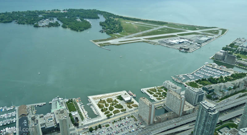
Toronto Island Airport (YTZ) is a unique and picturesque airport located on the Toronto Islands, just minutes from downtown Toronto. This intimate urban airport serves as a gateway to Canada’s largest city while maintaining a distinctive island setting surrounded by Lake Ontario’s turquoise waters. The aerial view showcases the remarkable blend of urban infrastructure, green spaces, and natural waterfront beauty that makes this airport a memorable departure and arrival point for travelers.
The airport’s strategic location on the islands provides visitors with breathtaking panoramic views of downtown Toronto, the CN Tower, and the surrounding Lake Ontario landscape. Its compact, well-designed runway and modern facilities make it an efficient alternative to larger regional airports, while the island setting preserves a sense of tranquility and natural beauty.
Late spring through early fall (May-September) offers the best weather for clear aerial views and comfortable exploration of the surrounding islands. Summer provides ideal conditions for enjoying the waterfront parks and outdoor activities.
Toronto Island Airport is accessible by ferry from downtown Toronto (2-minute journey), by water taxi, or by private boat. The airport is served by regional airlines offering flights to major Canadian and US destinations.
Toronto Island Airport represents a perfect intersection of modern aviation and natural beauty, offering travelers an unforgettable experience from the moment they arrive. Whether departing or arriving, the stunning aerial views of downtown Toronto and Lake Ontario create lasting memories. For visitors seeking a unique urban airport experience combined with access to pristine waterfront landscapes, Toronto Island Airport is an essential destination that captures the essence of Canada’s vibrant largest city.
Toronto Island Airport Aerial View, Toronto Canada Read More »